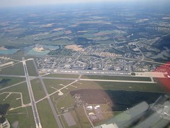
Millville
One thing I always talked about during training was flying to New Jersey to visit my friend Tony. With a cold front clearing out the humidity and haze, it was a great day to go flying.
I arrived at Manassas around 10 AM and got ready. The flight to Millville is about 130 knots each way, and I wanted to make sure the cockpit was organized. This was also my first flight using Aeroplanner to spit out the navigation log. One last review of the maps and the GPS, and it was time to go.
The first leg of the flight was Manassas to the stubby island in the Potomac river, then aim just to the left of the big powerplant on the Pautuxant River. Visability was so good I could see the smokestacks 20 miles away. I could see downtown DC and Andrews AFB. Once I crossed the Pautuxant, I turned on course to head directo Millville. This took my over the Chesapeake, Easton Airport, Ridgley airport(where I landed duing my student long XC flight) and Dover AFB.
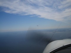
One interesting item on the flight out was clouds. I was cruising at 5,500, and had to keep an eye on the fair weather clouds that were at my altitude.
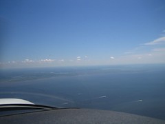
After an extended time over the Maryland and Delaware countryside(and believe me, it's very rural) I was happy to see the Delaware River. I could see clear across to the Millville airport, making it very easy to get set up for my arrival.
Everything about my landing at Millville was lacklust. Down low it was very bumpy, the criss-cross runway threw me off, and I really had to use the bathroom. I taxi'd over to the FBO, and got settled into a parking spot.
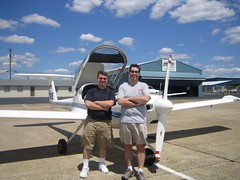
A nice lunch with my friend and his family, even if I was dog tired from the flight. Millville has a cool WWII aviation museum, and two diners on the field.
The plane full of fuel, I decided to take Tony up for a few minutes around the traffic pattern. He enjoyed himself, despite being on edge about the bumps.
Goodbyes said, I was off to the wild blue yonder. A long, steady climb up to 4,500 feet and even from this far out, I could see the Bay Bridge. I made sure to overfly Dover AFB. If they won't let us see our fallen soldiers, I wanted to get a photo of where they return to US soil.
Things were pretty routing until 15 miles out of Manassas. ATC has a C-130 fly in front of me. I don't like the idea of getting caught in the wake of such a big plane. I did a pair of slow, lazy 360s to wait for that to clear out. Then, when lining up to enter the pattern at Manassas, a commercial airliner flew above me. Probably wasn't really close, but it sure seemed that way. Executed another 360. At this point I was 5 miles from the runway, and tower just told me to make a long, straight in. A perfectly fine landing, and it was good to be home. I was beat. Total flight time - 3.4 hrs, ~260 nm flown, one new airport, almost got plowed by a C-130.
posted by Chris @ 6:14 PM
0 comments
![]()

0 Comments:
Post a Comment
<< Home